The next stop on the map is Bank of Canton, which is located at 743 Washington Street (between Grant Avenue & Kearney Street). It took us quite some time to find it, because it's not Bank of Canton any more. In 2002, United Commercial Bank acquired Bank of Canton of California. That's why we kept passing the bank without noticing it until finally we matched the address of the bank.
The former Bank of Canton
The pagoda-like building on the corner of Grant Avenue and Washington Street is formerly occupied by the Bank of Canton. It was built in 1909 as the Chinatown telephone office. From 1894 to 1949 there was a Chinese language telephone service which operated independently of the central San Francisco exchange; calls were put through manually. In 1847 the first San Francisco newspaper, the "California Star", was printed here.
Wednesday, October 25, 2006
Monday, October 23, 2006
Barbary Coast Trail (6) -- Golden Gate Fortune Cookie Factory
San Francisco Chinatown is the largest Chinatown outside of Asia. Even though I'm Chinese, I have never really walked around Chinatown. So it's a great opportunity for me to explore the oldest and one of the most historic Chinatowns this time. Established in the 1850s, SF Chinatown has been featured in popular culture, such as in film, music, photography, and literature. To me, the Chinatown doesn't look like anywhere in modernized China, it only looks similar to those scenes I've seen in the movie which talks about China at the beginning of the 20th century. I guess there is not much change to Chinatown after it's built at the gold rush time, amazing!
There are all kinds of shops in Chinatown, I think you can get whatever you want here, from small daily use stuff like bowls or hair product to expensive watches or jewelries. What attracts people to shop here is that most of the stuff sold here are very cheap comparing to other stores' price. Since everything is made in China, I guess those store owners have their exclusive sources to import the goodies with a very cheap price. H bought a nice wooden Samurai sword for only 10 bucks. He carried it in his backpack with the sword head sticking out of the backpack. He looked like a Ninja to me for the rest of the day. :P
SF Chinatown History Timeline
In Chinatown, beside the Barbary Coast Trail bronze medallion, there is also this kind of Chinatown bronze sign embedded in the sidewalk. (My feet are not included with the sign. :P) Following this sign, we arrived at Rose Alley.
Here, tucked inside a storefront on tiny Ross Alley, some 20,000 fortune cookies a day are handmade by two women, each manning a conveyor belt of what look like miniature waffle irons. The factory opened in August 1962, and though there are other fortune cookie bakeries in the city, this is the only one where the cookies are still made by hand, the old-fashioned way.
>>next
Sunday, October 22, 2006
Barbary Coast Trail (5) -- Old St. Mary’s Cathedral
Erected six years after the beginning of the Gold Rush. Towering over the corner of Grant Avenue and California Street is Old St. Mary's Cathedral, the first cathedral built in California, 1854. Just a block-and-a-half from the Chinatown Gate, Old St. Mary's also hosts a popular series of lunchtime classical chamber music concerts Tuesdays and Thursdays.
Old St. Mary's was designed by architects William Craine and Thomas England, who followed the instructions of the church's Bishop, Joseph Sadoc Alemany, to replicate a cathedral in his hometown of Vich, Spain. The new cathedral, built mostly with Chinese labor, had parapets on either flank, surmounted with embrasures and buttresses finished cut-stone pinnacles. Inside, a vaulted ceiling with groin arches rises above a Carrara marble altar imported from Rome.
The original plan included a steeple, but fear that an earthquake would send it toppling into the street led the designers to change the plans, leaving only a bell tower.
Granite, quarried in China, was used around the base of the structure to deflect rainwater, while bricks minted in New England for the outer walls came around Cape Horn as ship ballast.
In keeping with its tradition of community involvement, the church is home to several Twelve-Step groups and a vibrant gay and lesbian ministry, and holds a regular Saturday for Engaged Couples, a one-day, all-day series of presentations focusing the engaged couples' attention on the meaning of marriage from a Roman Catholic perspective.
>>next
Saturday, October 21, 2006
Barbary Coast Trail (4) -- Union Square
As soon as we found the first Bronze Medallion, it is a lot easier for us to identify the rest. The medallions are actually everywhere along the trail path -- huge, shiny, nicely engraved, very easy to follow.
Bronze Medallion
Following the bronze medallion, the next visiting spot is Union Square, which locates at Powell and Post.
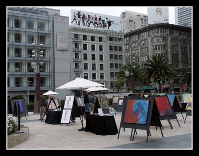
Union Square is the heartbeat of San Francisco itself -- ever changing, eternally celebrating, yet firmly rooted in its glorious past. Two years before the Gold Rush, in 1847, Jasper O'Farrell created a design for San Francisco, with Union Square as a public plaza. By the 1880s, it was a fashionable residential district, and in 1903, the towering monument was added, topped by the bronze goddess Victory, modeled after Alma de Bretteville Spreckels, known for her enormous influence in the San Francisco art community. After the great earthquake of 1906, Union Square became San Francisco's premier shopping district, and, by the 1930s, the site of the world's first underground parking structure. Today, as a result of an international design competition and a $25 million renewal, Union Square is reborn. It's the obvious place to meet, enjoy coffee, or just let the world go by. Featured are a large central plaza with a terraced performance state and lawn seating...four grand entrance corners bordered by signature palms...a café pavilion with outdoor seating...visitor information and ticketing services...and four magnificent light sculptures; and, of course, Victory, surveying the vitality of one of the world's great cities.
Union Square. Macy's is right next to union square, and Cheese Cake Factory is on the top floor of the building.
Across Powell Street from Union Square, there is St Francis Hotel, which is the first hotel build around Union Square. It was first built in 1905. But just one year after it's built, in 1906, the great earthquake and fire destroyed all builds around union square. St Francis hotel was rebuilt and expanded after that.
St Francis Hotel
Timeline of Union Square history
>>next
Friday, October 20, 2006
Barbary Coast Trail (3) -- Powell Street
The Cable car starting point is located at Powell and Market Street. I didn't really take Cable Car for visiting before; just like that I have stayed in Shanghai for so many years, I've never really been to the famous Yu Garden. 真是越近在眼前的东西越不怎么在意啊!
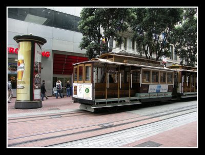
Until the day I walked the Barbary Coast trail, I just realized that I have been stupid for such a long time. I always thought that the cable car is just like the tram -- it is powered by the engine in the tram but runs along the rail. H was teasing me quite a lot on that. :P Now I learned that it runs by the cable underground. Of course, Cable car has to be run by Cable, literally, how stupid I was! The cable kept running underground all the time, the cable car just grabs the cable when it needs to run, and looses the grip and brakes when it needs to stop. It doesn't have a power inside at all! If you look closely between the gap of the rail, you can see the cable running underground. We did that a few times, staring at the ground to see how cable works, then people stopped next to us, trying to find out what we were looking at, they may wonder whether we found a gold mine there! :P A new gold rush age!
Cable car @ Powell street
It is also interesting to see how Cable car makes a U-Turn at the station. Since the rails (back and forth) are pretty close to each other, and cable car size is not small, it's kind of hard for Cable car to make a U-turn after it comes back to the station. So a big turning wheel with rail is built on the ground. The wheel's diameter is about the Cable car's size. And the rail is connected to the one side of rail first, when Cable car gets on the big wheel, the whole wheel will be turned certain degrees by human force, so that the rail will connect to the other side of rail and cable car can keep on going. It is pretty amazing to see how it works.
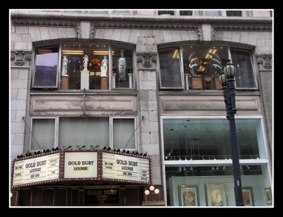
Walking along Powell street, there are very nice antique shops along the street. I love the window design there. Maybe I shall study to be a window designer.
The antique shop has lots of interesting stuff, like those very delicate carved elephant trunks, it looked to me like the very precious Chinese antiques. I wondered how they get those. By robbering or stealing from China during the Qing Dynasty?
In front of an antique shop.
Monkey A: Hear no evil
Monkey B: See no evil
Grace: Think no evil
Monkey C: Speak no evil
>>next
Tuesday, October 17, 2006
Barbary Coast Trail (2) -- Hallidie Plaza
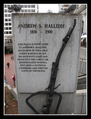
Hallidie Plaza
Hallidie Plaza is located at Powell and Market Street. I always pass that area, but have never known it has a name before. The cable car station is right next to the plaza. Therefore there are lots of street vendors who are selling souvenirs to the tourists around the plaza.
Some street performers dancing around Hillidie plaza. Behind it, it's my favorite store -- Forever 21. (有装嫩之嫌 :P)
Bronze medallion
We walked around Hallidie plaza, watched the street performance, and browsed the souvenirs. Right while we were enjoying our moment, we suddenly remembered that we haven't seen one bronze medallion yet. So we started our search. We looked at the street corner, and went to check under each street vender's cart. We had no idea how it should look like and how big it should be. In my imagination, it's a small round yellow thing, kind of rusted and dusted, lying in some corner unnoticeable. We went to ask the street vender, hoping that they may have ever seen such a thing. Sadly no one has ever heard of it. We were about to give up, then I noticed there is this huge shiny thing lying in the middle of the walkway. I didn't even think that will be it because it's so big and shiny, and nicely engraved. It just looked too good to be true. But it has "Barbary Coast Trail" boldly and clearly carved on it, THAT'S IT -- our "Barbary Coast Trail" bronze medallion! 踏破铁鞋无觅处,得来全不费功夫!
The first bronze medallion we found,one arrow pointing to the way we come from, the other pointing to the way we need to go. Very clear instruction, excellent road guide, not like the rocks piled up by the rangers in the national park, this road sign will always give you a correct direction!
Andrew Hallidie
Andrew Hallidie is the father of the cable car. He promoted the first cable line in the world, the Clay Street Hill Railroad.
Andrew was born in London. His father held several patents for the manufacture of metal wire ropes. Hallidie had hurt his health through overwork, so he and his father visited California in 1852. Later his father returned to Britain but Hillidie remained in California. Andrew Hallidie mined, surveyed, blacksmithed, and built bridges. He became the first person to make wire rope in California. He built many suspension bridges in northern California. His cables were critical elements of suspension bridges, mine hauling systems, and an endless cable ropeway for industrial purposes which Hallidie patented in 1867. An important feature of the ropeway was a "grip wheel", a driving sheave with clips around its perimeter to keep the cable from slipping. Hallidie later used the grip wheel on the Clay Street Hill Railroad.
Various stories claim that Hallidie conceived of the idea of the cable railway while watching horses struggle to haul cars up Jackson Street, from Kearny to Stockton Street. The horses had to be whipped cruelly. They would sometimes slip and be dragged back down the hill. This may be true, but Hallidie took over an existing proposal for a cable railway from Benjamin H Brooks, who had not been able to find financing for his plan. In any event, Hallidie built a model cable railway and obtained financing from three partners. He received his first cable car-related patent on 17-Jan-1871. He had surveyed California Street for his line, but decided that it would be less expensive to build on Clay Street, and that Clay Street came closer to the peak of Nob Hill and so would offer a better demonstration of the system. Hallidie and his partners worked hard to sell stock in the line and did not have much success. The line and the grip which bears Hallidie's name were designed by engineer William E Eppelsheimer. The franchise demanded that a test run take place no later than 01-Aug-1873. The first test run actually took place early in the morning on 02-Aug-1873, but the city did not void the franchise. Most accounts say that the first gripman hired by Hallidie looked down the steep hill from Jones and refused to operate the car, so Hallidie took the grip himself and ran the car down the hill and up again without any problems. The line started regular service on 01-Sep-1873 and was a financial success. Hallidie's patents, managed by a Cable Railway Trust, made him rich.
>>next
Friday, October 13, 2006
Barbary Coast Trail (1) -- US Mint
The U.S. Mint is the starting point of the Barbary Coast Trail. It locates at Mission and 5th ave. When I first heard about U.S. Mint, I was wondering why mint is so important in American history, because I don't think many people like to eat mint except for mint flavored gum. :P 后来才得知,此mint非彼mint啊!Mint has another meaning which I've never known before -- mint can also be a verb, to make coins out of metals.
The United States Mint at San Francisco plays an important role in US's coinage. Although it does not currently produce circulating coins, it is the exclusive manufacturer of regular proof and silver proof coin sets that set the standard for numismatic excellence with their brilliant artistry, fine craftsmanship and enduring quality. With the California Gold Rush underway in 1849, the United States Mint was overwhelmed with the task of turning all that gold into coins. Also, transporting it all to Philadelphia for coining was both time-consuming and hazardous. So in 1850, President Millard Fillmore recommended that a branch of the United States Mint be established in California. Congress approved the plan in 1852, and the San Francisco Mint was born. In 1854, the San Francisco Mint opened its doors and began converting miners' gold into coins, producing $4,084,207 in gold pieces by December of that first year alone. The new mint soon outgrew the small brick building in which it was housed. In 1874 it moved to an imposing new facility, with walls of stone, resembling an ancient Greek temple. The Mint's production of coins was uninterrupted for 32 years, until the disastrous earthquake of 1906. Because the gas works were partially destroyed, operations stopped temporarily. But the beautiful, solidly constructed Mint building survived both the earthquake and the ensuing firestorm. In fact, the Mint was the only financial institution capable of operating immediately after the disaster and became the treasury for disaster relief funds, performing other emergency banking services as well. Coining operations resumed soon afterward and continued in this building until 1937, when Mint workers moved to a larger, more modern facility, the present United States Mint at San Francisco. Today, the United States Mint at San Francisco does not accommodate visitors, as all space is needed for personnel and machinery.
>>next
Thursday, October 12, 2006
Barbary Coast Trail -- Preface
Before the trail starts, let’s review some history of San Francisco.
The City and County of San Francisco is the fourth-largest city in California and the fourteenth-largest in the United States. It is located on the tip of the San Francisco Peninsula and has traditionally been the focal point of the San Francisco Bay Area.
October 9, 1776, the Spanish became the first Europeans to settle in San Francisco, establishing a mission named for Francis of Assisi. With the advent of the California Gold Rush in 1848, the city entered a period of rapid growth. After being devastated by the 1906 earthquake and fire, San Francisco was quickly rebuilt and is today one of the most recognizable cities in the world.
Golden Gate Bridge
October 2000, Grace stepped on the land of San Francisco and started her career as a software engineer.
September 2006, Grace is still living in this area as a software engineer, but she discovered the Barbary Coast Trail and took a self guided tour. From that trail, she learned more things about San Francisco than what she has learned in the past 6 years! She starts to love this city more and more now!
>>next
Wednesday, October 11, 2006
Barbary Coast Trail
Have you ever known that there is a marked trail in the city of San Francisco? Well, I have never heard of that until about two weeks ago, even though I have been in the Bay Area for about 6 years now. And yes, it is called "Barbary Coast Trail"!
What is "Barbary Coast Trail"? And why is it so special to be mentioned here? If you are a curious person as I am, you may already have googled it! But here, I will tell you my own expierence of this "Barbary Coast Trail", first handed! ;)
The Barbary Coast Trail is a 3.8 mile walk through the heart of historic San Francisco. As a pathway to San Francisco's past, a series of bronze medallions and arrows embedded in the sidewalk connect the trail’s 20 historic sites, which are shown in the following map (click on the map to see the whole map).
You may wonder now how I got to know about this trail, since I'm one of those kind who need to read "History for Dummies". :P But I have resources other than reading about it myself. My dearest friend H was surfing online and happened to see an introduction of this trail. He told me about it, I'm not particularly interested in history, but one thing really interests me is that you have to follow the bronze medallions to guide through all 20 historic sites. Since all medallions are embedded in the sidewalk, there is a good chance that they can be blocked by the street vender's cart. So you have to really look for them when you walk along the trail. Since neither of us knows how this medallion looks like, plus I just finished "Angle and Demon", the whole thing sounds an adventure to me. So we decided to explore the trail.
Journey starts ...
>>next
Subscribe to:
Posts (Atom)